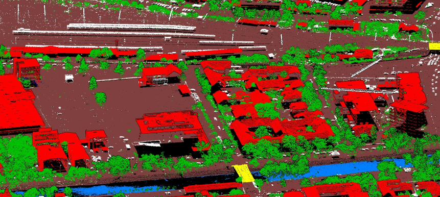
Classify LiDAR point clouds for mapping and asset workflows, using existing models or models trained on your own data.
Applications by industry
Detailed examples below come from the published mapping and powerline projects. Other listed industries do not imply a validated customer deployment. Use Cases links open the available projects, not a case study for every sector.
2D & 3D Mapping (Topographic, Mobile)
Classification problem
Separate terrain from buildings, vegetation and other objects in a large aerial survey.
Input data
Aerial RIEGL LiDAR, imported as LAS/LAZ. The published Primul Meridian project covered 13,500 km² at more than 50 points/m².
Confirmed classes and outputs
Ground, buildings, vegetation, bridges, water and human-made objects; classified point clouds, DTM/DSM and analytical reporting.
Practical use
Prepare terrain and surface models for mapping. In the Primul Meridian project, the final client used the DTM/DSM to analyse river beds.
Primul Meridian — National Scale DTM/DSM generation
Distinguish powerline assets from surrounding terrain and vegetation in a surveyed corridor.
Input data
ALS LiDAR. Terra Road Survey mapped 33.7 km of a 220 kV overhead line in a 100 m corridor at 80–150 points/m².
Confirmed classes and outputs
Ground, buildings, vegetation, towers, cables, phase conductors, guard wire and insulators in the classified point cloud.
Practical use
Use classified data in downstream asset inspection and vegetation management. Terra Road Survey built a digital twin and vegetation-risk maps within its own workflow; these are project deliverables, not standalone SEGMENT42 functions.